
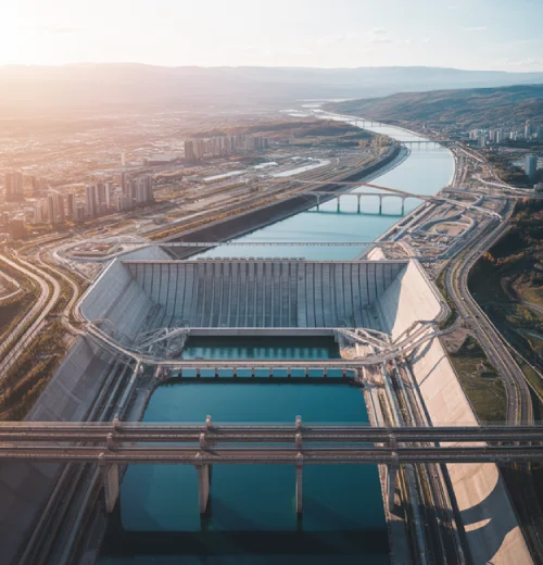
Infrastructure, Environmental & Maritime Users
From Montréal, RSat Space helps infrastructure owners, environmental agencies and maritime users turn satellite data into clear, actionable intelligence.
We deliver integrated space, ground and data solutions that monitor critical assets, coastlines and oceans, supporting safer, more resilient operations, regulatory compliance, long-term planning and rapid response in Canada and worldwide for ports, energy corridors, waterways and coastal communities.
Critical Infrastructure Monitoring From Space
Infrastructure operators across Montréal, Canada and allied markets rely on uninterrupted service, yet pipelines, grids, railways and transport hubs are difficult to inspect continuously. Gaps in coverage, access constraints and fragmented data make it hard to spot emerging risks early.
RSat Space designs remote-sensing missions that track corridors and critical nodes from orbit, combining optical, infrared and RF data with ground systems. Our satellites highlight anomalies such as land movement, encroachment, construction activity or interference before they disrupt service.
Using AI-driven change detection, we turn imagery into early-warning dashboards that asset, utility and transport teams can integrate into existing workflows. This reduces manual inspection burdens, improves safety and helps justify investment decisions for upgrades and resilience projects.
Environmental And Climate Intelligence Missions
Environmental agencies and climate programs in Montréal and beyond need objective measurements of land use, vegetation, water quality and pollution. Ground campaigns alone struggle to cover remote regions, seasonal changes and fast-moving events like floods, wildfires or industrial accidents.
RSat Space builds satellite platforms and payloads tuned for environmental monitoring, including multispectral, hyperspectral and infrared sensors. These missions map vegetation stress, thermal anomalies, coastal dynamics and inland water conditions, giving decision-makers evidence for regulation, conservation planning and climate-resilience investments.
Through remote sensing as a service, we can deliver processed products rather than raw imagery, from deforestation alerts to emissions-adjacent land-use tracking. This lets environmental users benefit from advanced satellites without building their own control centers or analytics pipelines.
Maritime Surveillance And Domain Awareness
Ports, coast guards and maritime regulators around Canada depend on accurate awareness of shipping lanes, fishing grounds and offshore infrastructure. Conventional radar and coastal systems leave blind spots offshore, while voluntary AIS signals may be switched off by some vessels.
RSat Space designs missions that fuse optical, radar and RF sensing with AIS data to highlight vessel positions, routes and behaviors over wide ocean areas. Our platforms support use cases from illegal fishing monitoring to offshore asset protection and enforcement.
By providing near-real-time alerts, pattern-of-life analysis and dark-vessel detection, we help maritime users prioritize patrols and investigations. This targeted approach improves safety, reduces operational costs and strengthens regulatory compliance for coastal authorities and commercial operators alike.
Port, Coastal And Offshore Security
Operators managing busy ports and coastal zones must balance throughput, worker safety and security while guarding against smuggling, unauthorized anchoring and environmental incidents. Traditional perimeter systems cannot always cover wide harbors, offshore approaches and complex industrial sites effectively or affordably.
RSat Space integrates satellite imaging, RF monitoring and selected ground sensors into tailored security concepts for terminals, refineries, offshore platforms and coastal infrastructure. Our solutions reveal activity patterns, highlight anomalies and support coordinated action between site security and relevant authorities.
Pipeline, Corridor And Asset Monitoring
Linear infrastructure such as pipelines, power lines, railways and highways often crosses remote or environmentally sensitive terrain. Unauthorized construction, vegetation encroachment, ground movement or third-party interference can stay unnoticed between patrols, creating downtime risks and potential safety or environmental incidents.
RSat Space provides corridor-focused monitoring services that flag change along predefined buffers, integrating satellite imagery, infrared data and AI analytics. Infrastructure teams receive prioritized alerts and visual evidence, enabling proactive maintenance, faster investigations and stronger reporting to regulators and stakeholders.
Disaster Response And Resilience Planning
Infrastructure, environmental and maritime users across Montréal and other regions face growing pressure from floods, storms, wildfires and industrial accidents. When events unfold, decision-makers need trusted situational awareness to protect people, assets, supply chains and critical services on tight timelines.
RSat Space configures rapid-tasking satellite missions and data pipelines that deliver before-and-after imagery, flood and fire extent mapping, damage triage and access-route analysis. These products slot into existing emergency-management systems, enabling faster, evidence-based prioritization of repair crews and humanitarian resources.
Beyond immediate crises, our teams support resilience planning by analyzing historical imagery and modeled scenarios. This helps authorities and operators assess exposure, test mitigation strategies and justify investments that harden infrastructure, protect coastal communities and support long-term environmental stewardship.
Data Delivery And Decision Support
Many infrastructure, environmental and maritime organizations lack in-house satellite expertise or processing capacity. Raw imagery can overwhelm teams that mainly work with GIS layers, dashboards and operational systems designed around assets, routes, permits or regulatory thresholds.
RSat Space offers end-to-end data services that convert complex measurements into intuitive products, APIs and alerts aligned with existing tools. We work with users to define thresholds, formats and workflows so satellite intelligence becomes a daily, trusted input to decisions.
Flexible Engagement Models For Operators
Different users require different levels of ownership and control. Some want dedicated satellites and payloads designed around a single port, corridor or environmental program, while others prefer to buy access to shared constellations or remote-sensing as a managed service.
RSat Space supports both models, from bespoke mission development to subscription-based data access for infrastructure, environmental and maritime users. Our Montréal team and international partners help select the right approach for budget, regulatory context, security requirements and long-term growth plans.
Sustainable Operations And Regulatory Compliance
Infrastructure and maritime programs increasingly operate under strict environmental, safety and reporting obligations. Authorities and investors expect verifiable evidence of compliance, while communities demand transparency about impacts on coastlines, ecosystems, shipping routes and industrial corridors.
By combining precise, repeatable satellite measurements with robust analytics and documentation, RSat Space helps users demonstrate responsible operations and support ESG reporting. Our solutions are designed to complement existing monitoring regimes, offering an independent, auditable view of change over time.

Phone Number
+1 514-399-1097
Business Location
2329 Guenette St, Montreal, Quebec H4R 2E9, Canada
E-Mail ID
[email protected]Questions From Infrastructure And Maritime Users
How can satellites protect critical infrastructure?
RSat Space designs satellite missions that continuously track corridors, sites and coastal zones linked to your assets. By combining optical, infrared and RF sensing with AI change detection, we highlight anomalies such as land movement, encroachment or unplanned activity early, supporting maintenance planning, risk reduction and regulatory reporting.
What environmental monitoring services do you provide?
Our environmental monitoring solutions use multispectral, hyperspectral and infrared payloads to map vegetation health, water quality, heat islands and land-use change over time. We deliver processed layers and indicators rather than raw pixels, helping agencies and infrastructure owners in Montréal and beyond quantify impact, demonstrate compliance and design climate-resilient projects.
How does maritime domain awareness work?
For maritime domain awareness, RSat Space fuses satellite imagery, radar concepts, RF sensing and AIS data to reveal vessel locations and behaviours over wide ocean areas. We help coast guards, port authorities and offshore operators detect dark vessels, unusual patterns and risks around critical maritime infrastructure, improving safety and enforcement planning.
Do we need to own a satellite?
No. Many infrastructure, environmental and maritime users choose RSat Space precisely because they do not want to own or operate satellites. Through remote sensing as a service, we manage space assets, tasking, processing and analytics, while you access secure web portals, APIs or reports aligned with your workflows.
How frequently can you monitor assets?
Monitoring frequency depends on orbit, sensor type and your priority areas. RSat Space typically designs services that revisit key corridors, ports or coastal zones from daily to weekly, with higher cadence during events such as floods, storms or suspected interference. We tailor revisit rates and delivery schedules to your operational tempo.
Is RSat Space data secure and compliant?
Yes. RSat Space operates under Canadian regulatory frameworks, export-control processes and cybersecurity practices suitable for defense, infrastructure and environmental programs. We implement secure data handling, encryption and access control, and can align with client-specific requirements for data residency, classification and audit trails so your satellite-derived intelligence remains protected throughout its lifecycle.
Can you integrate with our existing systems?
RSat Space expects most infrastructure, environmental and maritime users to have existing GIS, SCADA, port-management or emergency-response systems. We design our data products, APIs and alerting to plug into those platforms, reducing change-management effort. Our teams work with your IT and operations staff to test, validate and maintain reliable integrations over time.
Why Choose Us for Infrastructure, Environmental & Maritime Users
Choosing a satellite partner for infrastructure, environmental or maritime programs is ultimately about trust in the data that will drive high-consequence decisions. RSat Space combines Canadian-built platforms with a multi-domain mindset, so we understand how a new layer of space-derived intelligence must align with port operations, corridor maintenance, regulatory processes and community expectations.
Rather than starting from a catalogue of sensors, we start from the decisions your teams need to make: where to deploy crews, when to close a route, how to prioritise inspections, which vessels to investigate. We then design or configure satellite missions, data products and alerts that answer those questions clearly and consistently.
Because RSat Space controls the full stack—from satellite bus and payload through propulsion, ground segment, data processing and analytics—we can tune performance, revisit rates and latency for each use case. This integrated approach lets us support everything from a single port or watershed to multi-country infrastructure and maritime surveillance programs on realistic budgets.
Our teams also speak the language of infrastructure planners, regulators and emergency managers. We document methods transparently, support audits, and design training so staff can interpret satellite intelligence with confidence. With RSat Space, you gain a long-term mission partner committed to sustainable operations, measurable value and reliable support throughout the life of your infrastructure, environmental or maritime initiative.

Happy Customers
Read Reviews...

Our port authority needed better maritime surveillance beyond the harbour radar footprint, especially for unreported anchoring and potential smuggling activities. RSat Space designed a maritime domain awareness solution that fuses satellite imagery, AIS and RF data around our approaches. The system now flags dark vessels and unusual patterns automatically, giving our teams targeted leads and significantly improving compliance checks without adding more patrol boats.
— Sophia Bennett
⭐️⭐️⭐️⭐️⭐️
As the operator of a large pipeline network crossing remote regions, we struggled to maintain visibility between aerial patrols and ground inspections. RSat Space implemented a critical infrastructure monitoring service that tracks our right-of-way using optical and infrared imagery plus AI change detection. Within months, satellite corridor surveillance highlighted subtle slope movement near a river crossing, allowing preventive reinforcement and detailed reporting to regulators.
— Michael Turner
⭐️⭐️⭐️⭐️⭐️
Our environmental agency was looking for satellite data services but lacked the internal capacity to manage tasking, processing and analytics. With RSat Space, we now receive ready-to-use environmental monitoring products for wetlands, forest health and land-use change across our jurisdiction. Their remote sensing as a service model delivers consistent time series, clear documentation and responsive support, which has strengthened our climate-adaptation planning and public reporting.
— Emma Clarke
⭐️⭐️⭐️⭐️⭐️
As a coastal city responsible for roads, bridges and flood-prone neighbourhoods, we needed better situational awareness during storms. RSat Space set up a disaster response monitoring package that provides pre- and post-event imagery, flood-extent mapping and access-route analysis tailored to our infrastructure portfolio. The satellite-based damage assessment has helped us prioritize crews, coordinate with provincial partners and justify funding for resilience projects.
— Daniel Reid
⭐️⭐️⭐️⭐️⭐️Plan Your Monitoring Mission
Ready to strengthen how you monitor infrastructure, environments or maritime operations? Share a few details about your assets, region of interest and decision timelines, and RSat Space will outline tailored satellite and data options. Use the form to ask technical questions, compare approaches or request a proposal so our team can design an evidence-based solution around your operational needs today.
